Del Norte
Find locally-rooted places and experiences to enrich your visit and support the community
GoGood in Del Norte
Choose authentic local places committed to stewardship and sustainability. Sign up to save places, plan trips, and promote your place on GoGood.
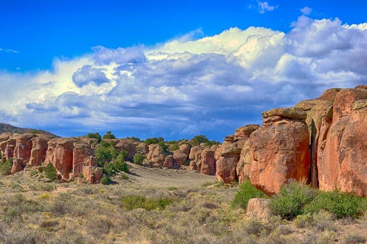
Elephant Rocks
The BLM’s Elephant Rocks Area is three miles north of Del Norte and south of Penitente Canyon Recreation Area. The Elephant Rocks area is 378 acres at an elevation of 7,900 feet and managed by the San Luis Valley Field Office of the Bureau of Land Management (BLM). This unique geologic formation allows for hiking, mountain biking, and climbing opportunities. A weathered remnant of the Fish Canyon tuff, it was once habitat for the Columbian mammoths that lived in the San Luis Valley during the Pleistocene Epoch. Local legend has it that these giant creatures left their mark on the rocks, leaving ‘rubs,’ smooth surfaces 8-10 feet above the average man. This is a five-mile long formation of monolithic boulders within a mix of short grass prairie and foothill shrub land. This fascinating area is full of amazing scenery as well as great Pinyon-Juniper and shrubland birds. It is good for Rock Wren, Green-tailed Towhee, Ash-throated Flycatcher, Bushtit and Pinyon Jay, and Cassin’s Kingbird (a rare bird in the San Luis Valley) has been seen here too. Poorwills call from the rocks at night. Several species of lizard scamper over the boulders, and with luck you might see a snake. You won’t miss the chipmunks and the rock squirrels. Getting Here From the intersection of US 160 and CO 112 in the center of Del Norte, head north on CO 112 about three miles and turn left (north) on Rio Grande CR 33. The Elephant Rocks begin almost immediately to the west of this road. To get to the Saguache County portion, continue north about three more miles until Rio Grande CR 33 becomes Saguache CR 38-A. Trusted Sources Del Norte Trails Organization Colorado Birding Trail
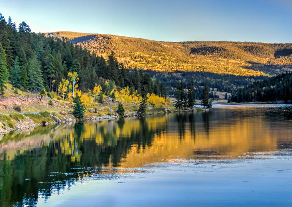
Beaver Creek Reservoir
Encompassing 102 acres within Rio Grande County, the Beaver Creek Reservoir State Wildlife Area beckons as a captivating outdoor recreation area, renowned for its fishing, boating, picnicking, hiking and camping opportunities. The historic Beaver Creek Reservoir Dam, with over a century of history, holds immense importance in the water management of the San Luis Valley. In the 2010s, notable enhancements were undertaken by Colorado Parks and Wildlife, followed with regular reservoir fish stocking ever since. Things to Do Campgrounds Three campgrounds provide access to the reservoir. Cross Creek is closest (12 sites with tables and fireplaces; access to vault toilet). Upper Beaver Creek and Lower Beaver Creek are nearby. Fishing Endless reservoir banks and boating options allow anglers to cast for rainbow trout, brook trout, brown trout, kokanee salmon. Boating Boaters have use of a concrete boat ramp to gain access to more than 4,400 acre-feet of water. No wakes are allowed, trolling motors are okay. Canoes and float tubes are allowed. Winter Recreation South Fork's favorite sled hill is located on the upper end of the reservoir and it's a favorite location for local ice fishing. Plan Your Visit Go south of town on Hwy 160 and turn left on Beaver Creek Road. Follow this road for 7 miles to the Beaver Creek Reservoir. Fish, boat or just admire the scenery. Great creek fishing stretches below the dam for several miles. Continue on this road another 13 miles to Poage Lake. A short 1/4-mile hike gets you to the banks of the picturesque lake. Back-track to the turnoff, and the route also continues on to Summitville and loops back through Del Norte, for a full day’s trip.
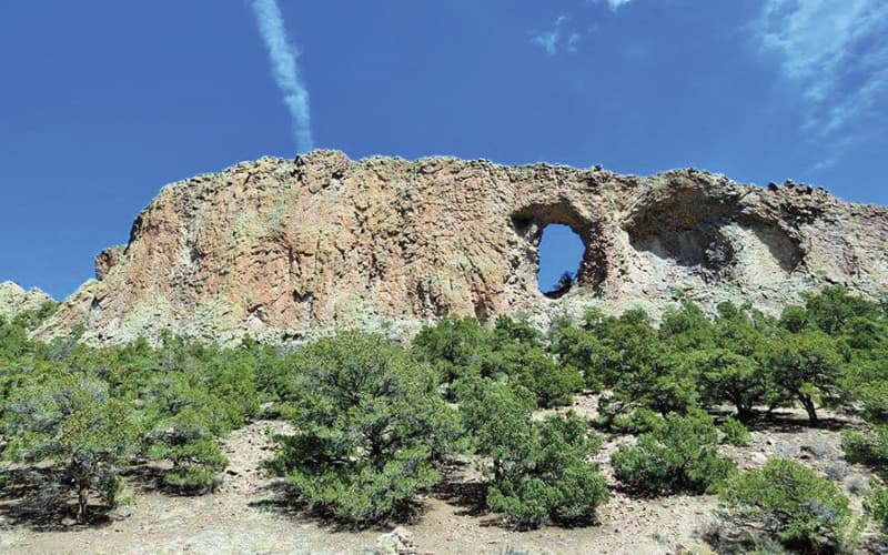
Ventana Natural Arch
Ventana Natural Arch is different from many of the others you’ll find scattered around Colorado. Rather than being formed from uplifted sandstone as most arches are, the Ventana Arch formed within a magma intrusion called a volcanic dike. Lava from the Summer Coon volcanic complex intruded into cracks in the surrounding alluvial and volcanic deposits about 30 million years ago. Parts of the magma cooled at different rates and separated from the rest of the wall, and when the surrounding deposits eroded away, the inner part of the arch collapsed, leaving a hole in the dike. The end result was a 40-foot-tall, 30-foot-wide arch. A steep hike—more of a scramble, really—leads to the arch. The scramble is rewarded with views across the San Luis Valley to the Sangre de Cristo mountains and the Great Sand Dunes National Park. The arch itself, however, is difficult to see from any direction except directly in front of or behind it. The arch is a sacred site for the Jicarilla Apache and Ute tribes and is still used for ceremonies. Getting Here The arch is about 11 miles northwest of Del Norte, Colorado, on Forest Service Road A23. The road is rough and a high clearance vehicle is advised but not required. Signs in the area point to the arch. When hiking to the arch, wear sturdy shoes with good grip. Caution is warranted when climbing to the arch and when descending. Loose rock requires caution and stable footing. To get to the Arch from Monte Vista – head north out of Monte Vista on Highway 285 for 18 miles to County Road G. Turn left and go west to the “Y” just past the La Garita Store. Take the dirt road south and follow the signs to the Natural Arch. Make sure you bring your camera to snap photos of the massive arch and the surrounding volcanic remains. Nearby Sights Other sights in the Penitente Canyon area include numerous petroglyphs, hikes, rock climbing, a campground, and a nifty Trading Post serving the best burgers in the San Luis Valley. The closest real town is Del Norte, which offers a small amount of lodging, shopping, and dining, including a microbrewery, Three Barrel Brewing.
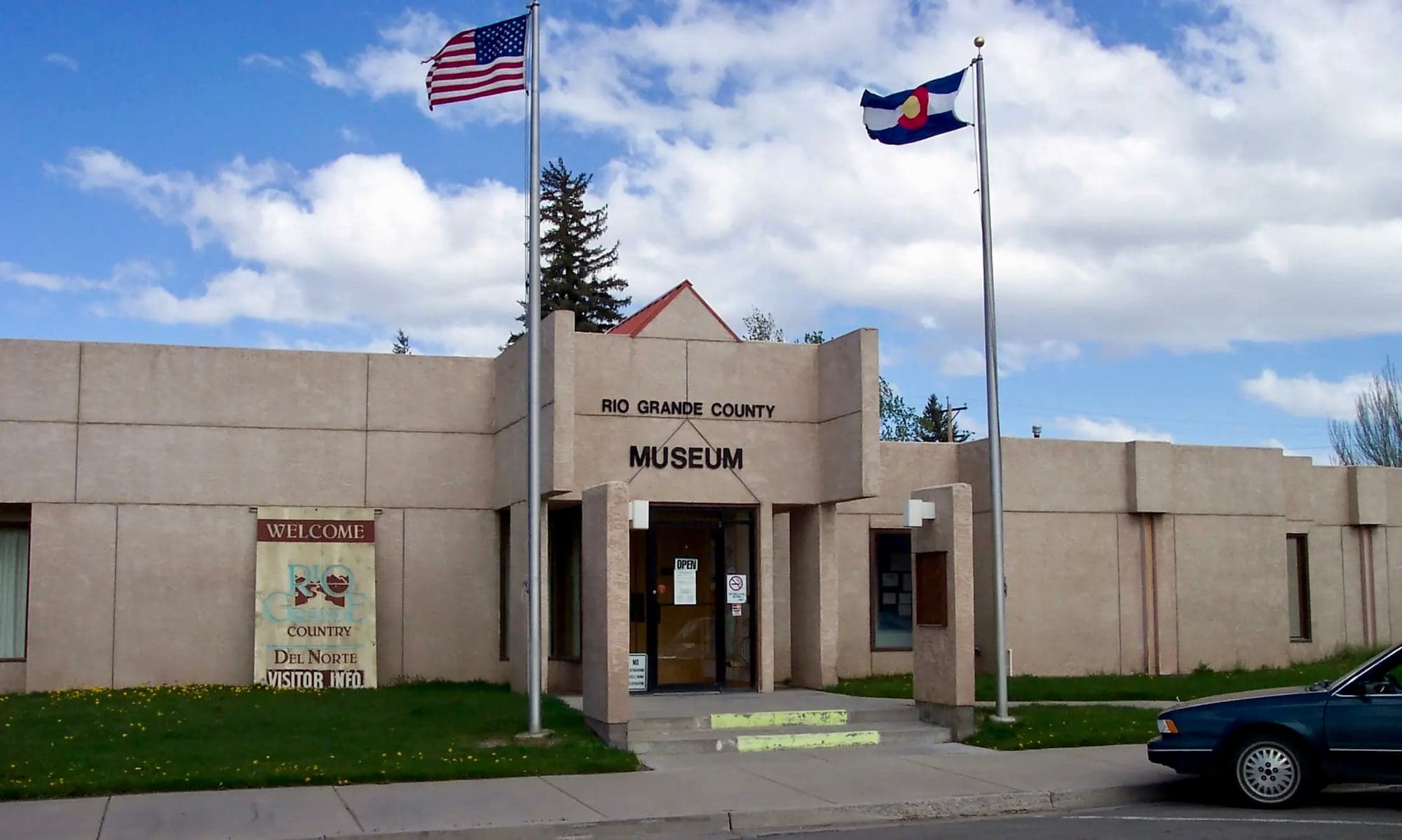
Rio Grande County Museum
Our mission is to preserve and share our rich history in Rio Grande County. Our past transcends from early settlers leaving cliff drawings to the Wild West filled with stagecoaches, gold mining, logging and farming. Still today, our cultural heritage can be seen in every corner of our area. Come explore what makes Rio Grande County a flourishing combination of past and present. Things to Do Adult Programs The Rio Grande County Museum hosts several adult-based programs throughout the year. Everything from local Rock Art tours in partnership with the Bureau of Land Management to presentations from local historians and archeologists, we have something for everyone on our schedule of events. Funding from these events helps us provide more programs throughout the year and donations are always welcome. Calendar Get Involved Donate If you would like to support the Rio Grande County Museum through a donation, you can easily show your support by donating online or by mail.
Jackalope Anglers
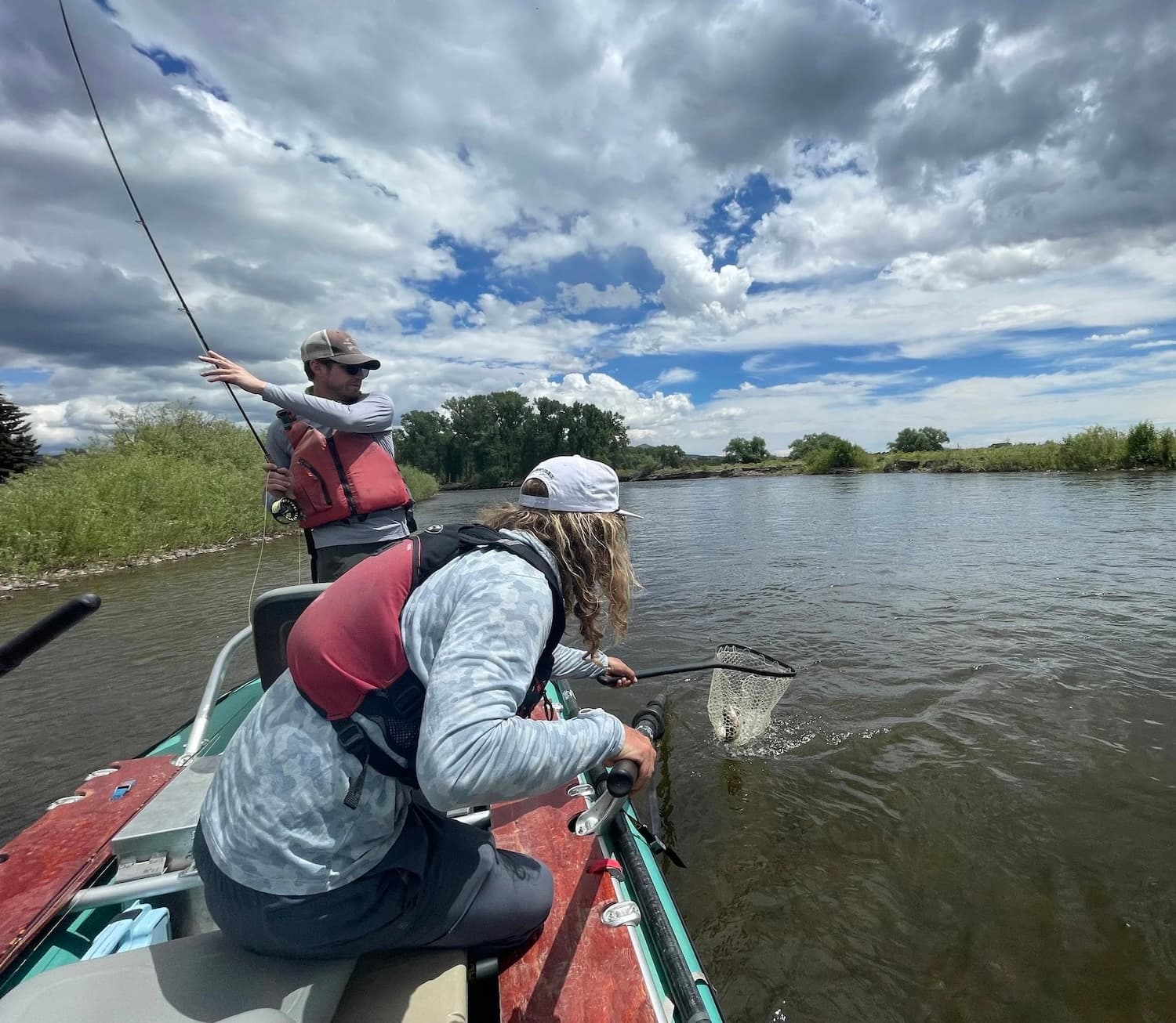
Jackalope Anglers was created with the idea of utilizing the Rio Grande for the amazing fishery that it is at the same time as upholding the values of conservation and preservation. We want to show people the gold medal waters that exist here and yield some of the best fishing in the area. We deliver the highest quality float fishing and guiding that we can in hopes of developing lasting relationships with our clientele and creating memories for a lifetime. Wade Fishing Join us on an excursion by foot around the Rio Grande River. We offer half and full day trips. Float Fishing Join us on an amazing float fishing trip down the Rio Grande River. We offer half and full day trips. Take a Lesson Interested in learning the art of Fly-Fishing or just need to brush up after not having been able to get out for a while? Look no further we can teach you the skills to be catching fish in no time and get you back on the water casting like a pro. If you have any additional questions please feel free to give a a call or email. Fly Shop The Jackalope fly shop is open and providing the essentials for getting you out and catching fish. A selection of flies that are tried and true by the professionals on our fishery are available. We also have some of the accessories like nipper, forceps, strike indicators and floatant. Come by and grab some river appropriate apparel. Branded sun hoodies and hats that keep you comfortable on the water. Additional river specific gear is also available. About our company Some guide services exist because someone saw a business opportunity. Jackalope Anglers exists because a guide spent years fishing the best trout water in the country, discovered the Rio Grande near Del Norte, and could not stay away. What started as a deep personal connection to a river that most Colorado anglers had overlooked became a professional commitment to sharing that river with anyone willing to make the drive south and spend a day on the water with someone who genuinely loves it. That is the short version of how Jackalope Anglers came to be. The longer version involves a lot of river miles, a few remarkable fisheries, and one guide who kept coming back to the same stretch of the Rio Grande until he finally decided to stay. Learn more about us.
Penitente Canyon
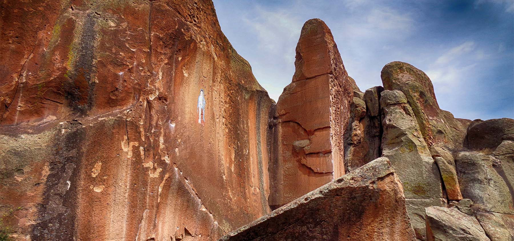
If technical rock climbing is your type of adventure, then Penitente Canyon may have what you want. The canyon is known for its nearly 300 world class technical rock climbing routes. South-facing routes can be climbed year-round within the Recreation Area. Numerous Trails are also available for your enjoyment within Penitente Canyon SRMA. Other attractions include trout fishing in La Garita Creek and primitive camping. For more information, please contact the San Luis Valley Field Office. If you’re not the rock-climbing type, there are manageable hiking trails that will take you close to the action. Try to spy one of Colorado’s rarest plants, the neo-parrya, scaling the cliff walls. The canyon is part of the Bureau of Land Management’s 4,552-acre recreation area of the same name, and there is a network of single-track trails for bikers and horseback riders, in addition to a campground. History buffs will relish the Native American and Spanish history in the area. The canyon got its name from Los Hermanos Penitentes, a Spanish religious sect that favored Pentinente Canyon for its solitude in the 1880s. When you visit to capture a bit of your own solace and spirituality, don’t miss the Virgin of Guadalupe painted high on a canyon wall and the ruts of ox carts that remain from the days when the Old Spanish Trail traversed the area. Activities Rock Climbing Penitente stands as a haven for rock climbers. With its soaring cliffs and intricate rock formations, this canyon offers a diverse range of routes suitable for climbers of various skill levels. Penitente Canyon's allure lies in its varied rock types, from limestone walls to pockets and challenging overhangs, creating an exciting playground for climbers. The canyon's bolted routes cater to both sport climbing enthusiasts and those seeking a taste of the outdoors. More about Rock Climbing History and Culture Penitente Canyon's rich history intertwines with its geological wonders. History buffs will relish in the Native American and Spanish history of the area. Pictographs (painted panels) discovered there depict game drives and hunting expeditions, likely drawn by the Puebloan, Apache or Ute tribes. The canyon is named after Los Hermanos Penitentes, a secretive religious brotherhood that favored the Canyons in the 1880s for their solitude. The group practiced a blend of Catholicism infused with indigenous beliefs and traditions. The Penitentes were known for their rituals and acts of penance, often involving self-flagellation and reenactments of Christ's crucifixion during Holy Week. When you visit, don’t miss the Virgin of Guadalupe painted high on a canyon wall, and the ruts of ox carts that remain from the Old Spanish Trail. Hiking and Mountain Biking Exploration in Penitente Canyon isn't limited to climbing alone. An extensive singletrack trail system is used by hikers and mountain bikers, traversing the stunning landscape and discovering the unique flora and fauna that call this canyon home. The entire recreation area’s over 7,000 acres is open to the public. La Garita Natural Arch or "La Ventana" La Garita Natural Arch, affectionately known as "La Ventana," stands as a majestic geological wonder and is said to be a sacred site for the Jicarilla Apache and Ute tribes. Getting There From Highway 285 turn west on County Road G, travel about 6 miles to La Garita follow County Road 38A until you see the Penitente Canyon turn off on your right, less than a mile. From Del Norte travel northwest on Highway 112 to road 38A turn north, stay on 38 A until you see signs for Penitente Canyon, about 8 miles.
Mellow Moon Lodge
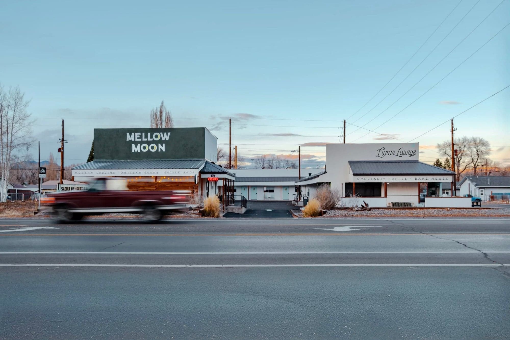
Once a 1940s roadside stop known as El Rancho Motor Lodge, our revived property is now a modern boutique motel where small-town soul meets slow hospitality. With fifteen well-appointed and newly-renovated guest rooms, this roadside gem is 100% smoke-free, dog-friendly, and designed with thoughtful amenities throughout. On-site, guests can browse local goods and provisions at Rodeo Mercantile and enjoy specialty coffee and creative craft bakes at The Lunar Lounge. Accomodation All rooms feature adaptive foam Tuft & Needle mattresses, organic Coyuchi towels and linens, premium branded robes, and full-size, all-natural bath products. No two rooms are exactly alike, but each includes keyless entry, a smart TV (streaming only), electric kettle, mini fridge, custom souvenir mugs, and complimentary drip coffee in the Lounge during posted hours. Guests also have 24/7 access to The Canteen—a self-serve amenity space with an ice machine, water refill station, utility sink, and microwave, plus a rotating selection of thoughtfully curated snacks, beverages, convenience items, and merch available for purchase, on the honor system. Discover Del Norte The Mellow Moon Lodge sits at the heart of Del Norte’s world-class trail system—just five minutes from the Rio Grande River, 30 minutes from Wolf Creek Ski Area, and under an hour from Great Sand Dunes National Park. Come adventure with us! Scroll below to explore our curated destination map featuring our favorite places to eat, drink, shop, and explore around town and across the San Luis Valley in beautiful Rio Grande County.
Tin Can Camp
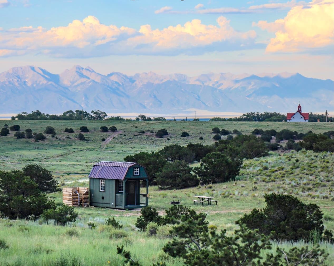
Tin Can Camp sits in the heart of Colorado’s San Luis Valley, surrounded by rugged landscapes and right at the entrance of Penitente Canyon. Managed by San Luis Valley Great Outdoors (SLV GO!), Tin Can Camp was created to preserve our natural spaces and create equitable access to the outdoors for all. Every stay directly contributes to conservation projects across the valley, so when you visit, you’re helping us protect this land for future generations. Accomodation Our eco-friendly cabins offer an off-grid experience that brings you closer to the land, without sacrificing the essentials. The perfect base for exploring all that the San Luis Valley has to offer, Tin Can Camp is a sustainable retreat, where each stay contributes to preserving these beautiful landscapes for future generations. Amenities Perfect for adventurers who: Love being off the grid and surrounded by nature. Want to support conservation while enjoying an authentic outdoor experience. Are ready to bring their own gear, go without Wi-Fi, and embrace the wilderness. Probably not for those who: Need constant connectivity (Wi-Fi, TV, or cell service). Expect full-service amenities like air conditioning or housekeeping. Prefer the comforts of city life over the call of the wild. Getting Here Ah, the age-old question of adventure seekers everywhere! Tin Can Camp is nestled on a sprawling 200-acre property at the crossroads of Penitente Canyon Special Recreation Management Area and Carnero Creek Canyon. It’s the kind of spot where GPS signals go to lose themselves and adventurers find their way. We strongly advise following our detailed directions, provided upon booking. Google and Apple Maps? Let’s just say they haven’t quite earned their compass merit badges for this area yet. Trust us—you don’t want to end up on a “scenic” detour that involves your car asking existential questions. Follow our guide, and you’ll be relaxing at your cozy micro-home in no time! Contact Us: info@tincancampcabins.com
Del Norte Trails Organization
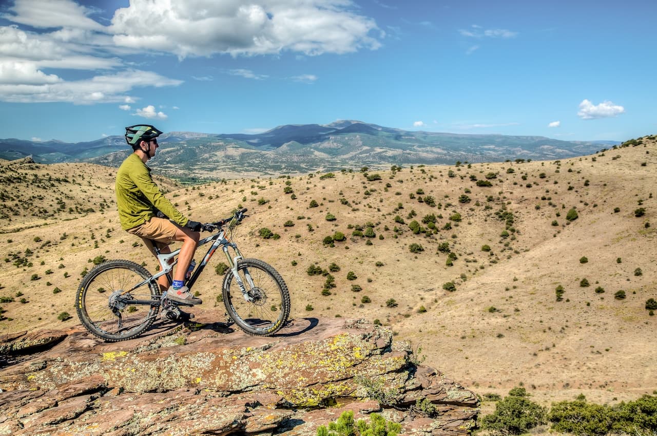
The Del Norte Trails Organization (DNTO) is a 501 (c) (3) non-profit Colorado registered corporation. We work with and assist our partners from the USFS, the BLM, Volunteers for Outdoors Colorado, Southwest Conservation Corps, SLV Rattlers high school mountain bike team, 12 Hours of Penitence Mountain Bike Endurance Race, and local organizations in as many ways as we can. DNTO works with towns, counties and SLVGO to come up with cohesive plans to connect our region. Our focus is non-motorized, purpose-built, single track trails connecting with the wealth of two track trails in the mountains that surround us. In conjunction with partners, in 2020 we completed the recreation feature on the Rio Grande, as it winds through Del Norte. Del Norte Trails Organization partnered with Rio Grande Headwaters Restoration Project, Trout Unlimited, NRCS, CU Denver, Riverbend Engineering, and the Town of Del Norte. To increase the scope of the project, Del Norte Trails Organization purchased 14 lots under and along The Rio Grande in the Town of Del Norte, which is now the Del Norte Riverfront Park, providing public amenities and access to the river. In 2022, Del Norte Trails Organization is completing the original Del Norte Trails Masterplan and scheduling trail building crews to put in the upper trail connector on the west side of Lookout Mountain. Trails & Maps Split from the crowd, get after it! Things to Do If you are seeking to explore Del Norte and the surrounding area, we recommend visiting these resources to help plan your path.
La Garita Trading Post
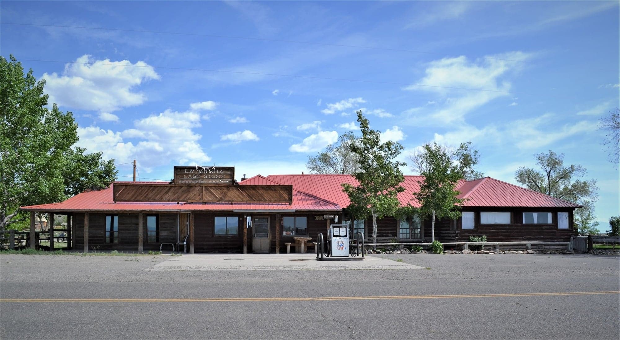
There’s a reason that La Garita Trading Post has stayed in business for over a century: when you walk in, you’ll feel like family. Whether you are in the mood for a home cooked meal, or are simply stopping by for a tank of gas, we’ll make you feel right at home. La Garita Trading Post has been a restaurant and convenience store in La Garita since before these things were commonplace. We have had over 100 years to perfect our trade, and we look forward to each and every visitor we receive. We are happy to welcome campers, hunters or those just passing through. Come in to La Garita Trading Post and you will be greeted by some of the most inviting home cooked meals you’ve ever laid eyes on. We are conveniently located near some of Colorado’s most famous hunting, fishing, camping and hiking spots, making La Garita Trading Post the best place to pick up supplies before your outing, in between excursions, stock-up on emergency food supply, or to refuel with delicious home style meals afterwards. We offer everything you need for a successful stay in the outdoors, from camping, hunting and fishing supplies to the convenience of a full restaurant in La Garita. At La Garita Trading Post, we can see to your needs, including: Breakfast, Lunch and Dinner: There is no replacement for a good home cooked meal. At La Garita Trading Post, you can have it all. Our restaurant serves breakfast daily until 10:30 am (11:00 am on Sundays) as well as lunch. We provide a special dinner on every other Friday as well. Convenience Store: Whether you’re gearing up for a long-term camping trip, or simply need a few provisions to get you through the night, we have everything you need at La Garita Trading Post. * Gas Station: Don’t get stuck with your gas tank empty. There are few gas stations in La Garita, so when you stop in, you will want to be sure to take in a few gallons before heading out. Hours of Operation Monday-Saturday: 7 a.m.-5 p.m. Sunday: Closed Resources 1. Uncover Colorado: La Garita 2. Penitente Canyone 3. Colorado Birding Trail
Rio Grande National Forest
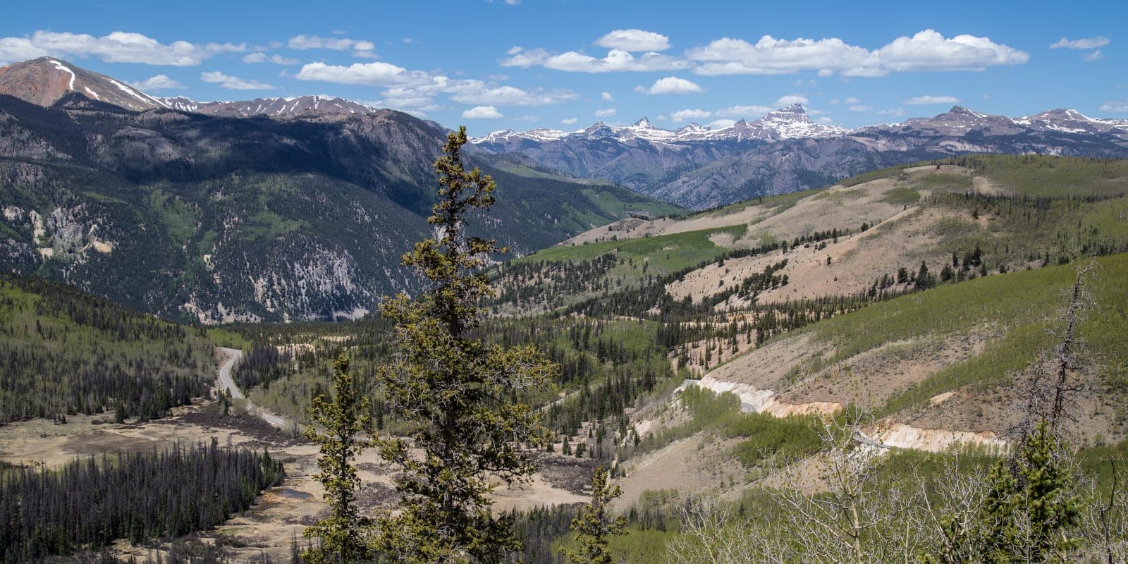
The 1.83 million acre Rio Grande National Forest is located in southcentral Colorado and remains one of the true undiscovered jewels of Colorado. The Rio Grande begins its 1800 mile journey to the Gulf of Mexico high up in the San Juan Mountains in the western most part of the forest. The Continental Divide runs for 236 miles along most of the western border of the forest and the jagged tops of the Sangre de Cristo Mountains form the eastern border. In between these two mountain ranges sits the San Luis Valley, a large agricultural alpine valley. The Rio Grande National Forest is composed of a myriad of ecosystems ranging from high elevation desert at 7600 feet above sea level to rocky crags at over 14,300 feet in the Sangre de Cristo Mountains. Portions of four Wilderness Areas make up almost a fourth of the forest. Things to Do Recreation From the Sangre de Cristo Mountains to the San Juan Mountains, the jagged peaks and rushing rivers of the San Luis Valley public lands wrap themselves around this Rocky Mountain basin. Whether viewing the mountain scenery from roads or finding a challenge on trails, visitors discover solitude and self-reliance through uncrowded year-round recreation opportunities. Camping The Rio Grande National Forest (RGNF) has 33 campgrounds with over 651 individual sites. The majority of the campgrounds are operated by a private concessionaire that is permitted by the RGNF. Some campgrounds have on-site hosts. While electric, sewer, and water hook-ups and showers are not available, most campgrounds have potable water and vault toilets. Eight of the campgrounds have sites that can be reserved. Reservations are recommended for holiday weekends. Many campgrounds have first-come, first-served sites. Plan Your Visit Alerts Stay up to date on what’s happening across the Rio Grande National Forest. Before you head out, take a moment to plan ahead. Check area restrictions and see the latest campground, road, and trail closures. You’ll also find current fire restrictions and other important updates. Current Conditions: Visit the Current Conditions page for the most recent information including road conditions, fire conditions, and more. About Forest Orders: Sometimes we need temporary rules to protect public safety or natural resources. When a situation isn’t covered by regular forest regulations, we issue a “Forest Order.” These orders create short-term prohibitions for specific areas or activities. Forest Orders appear below as Alerts. Volunteers The Rio Grande National Forest is a resource we all own, and volunteering is one way to take an active part of land management by being a steward of the land we all enjoy. Opportunities can range from a single-day project to a long-term undertaking lasting for several months. What captures your interest? Trail work, campground host, bird & wildlife surveys, invasive weed pulls, historic preservation, information receptionist, wilderness restoration, conservation education? There are many ways to transfer your love of the land to the management of the land. View our scheduled volunteer opportunities on the Rio Grande National Forest. Contact Us Thank you for engaging with your public lands! There are multiple ways to contact the Rio Grande National Forest. Please contact the District Office for the region of the forest you are looking for information about. See the map below for reference. You can also use the feedback form below to send a message. Office Phone Numbers: Conejos Peak Ranger District - La Jara, CO (719) 274-8971 Divide Ranger District - Del Norte, CO (719) 657-3321 Creede Office (Divide RD) - Creede, CO (719) 658-2556 Saguache Ranger District - Saguache, CO (719) 655-2547 * Headquarters - Please call the Divide Ranger District. Please visit our FAQs page for more information.
Built for Everyone in Responsible Travel
Whether you're planning your next adventure, running a local business, or stewarding a destination, GoGood provides the tools and insights you need.
For Travelers
Find authentic, locally-rooted experiences that connect you with culture, nature, and communities. Every choice you make creates positive impact.
For Businesses
Get listed on GoGood, measure your stewardship performance, and reach travelers who value local ownership and authenticity.
For Destination Stewards
DMOs, nonprofits, and community leaders: grow regenerative tourism that benefits your place and people while reducing negative impacts.
Tourism That Creates Positive Impact
Verified Stewardship
Every destination and business is assessed through the Stewardship Scan — built on Green Destinations' Good Travel Scan and extended with our Bonus questions on local ownership and certification.
Community-Centered
We prioritize local ownership, cultural preservation, and community well-being in everything we do.
Regenerative Tourism
Go beyond "doing less harm" to actually improving the places you visit through conscious travel choices.