
Los Caminos Antiguos Scenic and Historic Byway
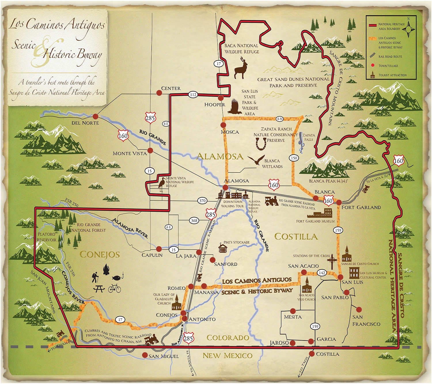
Running through the high-altitude San Luis Valley, along the base of the Sangre de Cristo Mountains, this 129-mile route connects some of the European settlements in Colorado. Meaning "The Ancient Roads," this day trip will inspire visitors with history, culture, and natural beauty.
Route Overview
Los Caminos Antiguos Scenic and Historic Byway will take you through the Sangre de Cristo National Heritage Area in Southcentral Colorado. This driving experience that will immerse you in vast, untouched natural beauty and inspiring narratives of native tribes, explorers, frontiersmen, buffalo soldiers, ranchers, miners, and railroad boomers.
- Length: Approximately 129–148 miles.
- Driving Time: Approx. 3–4 hours (without stops).
- Route: Connects CO-17, US-285, and CO-142, forming a triangle between Alamosa, Antonito, and San Luis.
- Highlights: Zapata Falls, Fort Garland Museum, San Luis Valley Museum, and the Stations of the Cross in San Luis.
- App: Utilize the TravelStorys app for a curated audio tour along the route.
Route Details
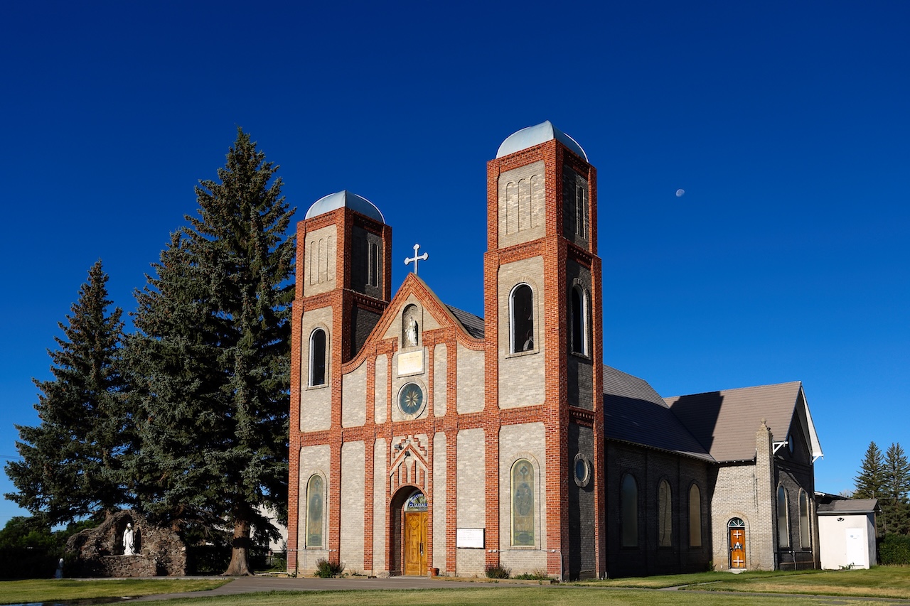
The San Luis Valley is a landscape speckled in a diverse cultural richness, that dates back over 11,000 years. As you crest one of the four major road passages into the San Luis Valley, your eyes lay sight on the majestic open skies, it is as if you traveled back in time. The Great Sand Dunes along the Byway are one of nature’s most painstaking creations. Hundreds of feet high and more than a thousand miles from the nearest ocean beach, these drifting dunes accumulated over the eons as winds swept sand against the west face of the Sangre de Cristo Range. That slow, determined process reflects the spirit of the San Luis Valley – an enormous, sun-baked flat between the Sangres, and the San Juan foothills. Life here would not seem to have changed much since the 1600s, when Spain cast its claim over this region. Los Caminos Antiguos takes you to Colorado’s oldest surviving community (San Luis, 1851), its oldest parish (Our Lady of Guadalupe, in Conejos), and one of its first military posts (Fort Garland).
This Byway begs you to drive and explore our collection of roads. Los Caminos Antiguos itself means ‘The Ancient Roads.’ Along the 129-mile, 3 county route, interpretive markers and the TravelStory app tell the story of the land, the people, and the history. The byway links the four Cornerstone Communities of Alamosa, Fort Garland, San Luis, and Antonito, as well as the Great Sand Dunes National Park, the San Luis Lakes State Park, the Alamosa National Wildlife Refuge, Zapata Falls, the Medano-Zapata Ranch, the Rio Grande National Forest, the Conejos River, Culebra Creek, and the Rio Grande.
Learn more about the history and heritage of the San Luis Valley:
- Sangre de Cristo National Heritage Area
- Colorado DOT Los Caminos Antiguos page
- Los Caminos Antiguos Facebook page
Sangre de Cristo National Heritage sangreheritage.org/los-caminos 623 4th St. P.O. Box 844 Alamosa Alamosa, CO 81101 loscaminos@sdcnha.org 719-580-7366
Colorado Welcome Center at Alamosa alamosa.org/colorado-welcome-center 610 State Ave. Alamosa, CO 81101 Toll Free: 800-258-7597 Local: 719-589-4840