Kootenai National Forest
The Kootenai National Forest is located in the extreme Northwest corner of Montana and Northeast Idaho and encompasses over 2.2 million acres, an area nearly three times the size of Rhode Island. The Forest is bordered on the north by British Columbia, Canada, and on the west by Idaho. Of the total acres, 50,384 are within the State of Idaho. Access into the Forest is via U.S. Highways 2 and 93 and Montana State Highways 37, 56, 200 and 508.
History The spectacular landscape of the Kootenai National Forest was shaped by continental and alpine glaciers. Valleys and their drainages were carved out and lakes were left behind. This created the land that the early American Indians inhabited, adapting to the mountains.
The prehistory of the Forest goes back at least 8,000 years, when people moved across the landscape hunting and gathering. Through the use of geological, biological, sociological, and archaeological evidence, archaeologists have been piecing together how the natives used this land called Kootenai. There is a tremendous amount of evidence of their occupation, that not only provides valuable information about their land use but also is considered by the Kootenai Tribe as a vital link to their heritage. The historical period of the Forest began with the arrival of the early explorer, David Thompson. Fur trading, railroad construction, mining and logging activities flourished in this vast land rich in resources. Evidence of these sites are also scattered throughout the forest.
Mountains and Rivers Ranges of high craggy peaks mark the Forest with Snowshoe Peak in the Cabinet Mountains Wilderness at 8,738 feet, the highest point. The Whitefish Range, Purcell Mountains, Bitterroot Range, Salish Mountains, and Cabinet Mountains are all part of the rugged terrain radiating from the river valleys. In the north central part of the Forest, the land is more open with gently rolling timbered hills lying in the shadows of the Whitefish Range.
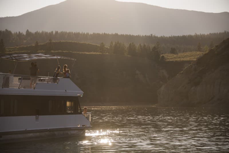
The Forest is dominated by two major rivers, the Kootenai and the Clark Fork, along with several smaller rivers and their tributaries. Two hydroelectric dams on the Clark Fork have created the Cabinet Gorge and Noxon reservoirs within the Forest boundary. State Highway 200 parallels these reservoirs as it crosses the Forest. The Kootenai River is spanned by another hydroelectric (and flood-control) project, Libby Dam. This structure located about 17 miles upstream from Libby, Montana, has created Lake Koocanusa, a 90-mile-long reservoir reaching northward into the Canadian Rockies. Lake Koocanusa is almost totally surrounded by national forest lands...no private summer home or condominium developments here. State Highway 37 follows the east shore to Rexford and beyond to Eureka, Montana. The elevation of the Kootenai River as it leaves the Forest and the State is 1,862 feet, the lowest point in Montana.
The Yaak, Fisher, Tobacco, and Vermillion Rivers are smaller rivers within the confines of the Forest. There are over 100 lakes inside the boundaries of the Kootenai ranging from small alpine lakes to 1,240-acre McGregor Lake.
Climate The climate of the Kootenai has been described as "modified Pacific maritime" in character, meaning that compared to the remainder of Montana, this area's climate resembles that found along the Pacific coast. The character becomes "modified" by occasional intrusions of the arctic air masses, more commonly found in the remainder of the State, which can bring winter temperatures down to -30° F. with heavy snowfalls in the mountains. Average annual temperatures of 45° F. reflect the moderating influence of the Pacific air masses. Summer temperatures are moderate with few days reaching over the 90° mark. The wet season in the Forest usually occurs in the fall and early winter.
Visiting Kootenai Special Places
Cabinet Mountains Wilderness Located within the heart of the Kootenai National Forest, the Cabinet Mountains Wilderness contains over 93,000 acres of beautiful, rugged, glacier-carved mountains.
Ten Lakes Scenic Area With the Canadian border on the north side, the Ten Lakes Area is dominated by a high ridge of the Whitefish Mountains. Alpine glaciers carved deep scallops, or cirques, and high, rim-rocked basins which shelter numerous small lakes.
Lake Koocanusa Scenic Byway This stretch of State Highway 37 parallels Lake Koocanusa for 67 miles. The view of the lake is fantastic and there are numerous camping, picnicking, and boat access points located along the byway. Two marinas are also on the byway.
Ross Creek Scenic Area This area contains a grove of ancient western red cedar trees growing along the banks of Ross Creek. A self-guided nature trail forms two loops of different length winding among the grove and providing views of many cedars up to 8 feet in diameter and 175 feet tall. Benches along the trail afford opportunities for rest and quiet reflection on the beauty and wonders of our natural world.
Kootenai Falls - Swinging Bridge Kootenai Falls is one of the largest free flowing waterfalls in the northwest. The calm river suddenly gathers momentum surging first through China Rapids and then over the falls, dropping 90 feet in less than a mile. The main falls is 30 feet high and can be viewed from a “swinging bridge” that crosses the river.
Stone Hill Rock Climbing Area Stone Hill has all the qualities of a premier sport climbing area. Climbers are attracted to this hidden area in the northwestern corner of the state because of the steep quartzite cliffs. The views of an open ponderosa pine forest and Lake Koocanusa make this undeveloped area stand out from the rest.